Featured Projects
Innovative solutions across water management, infrastructure, and research
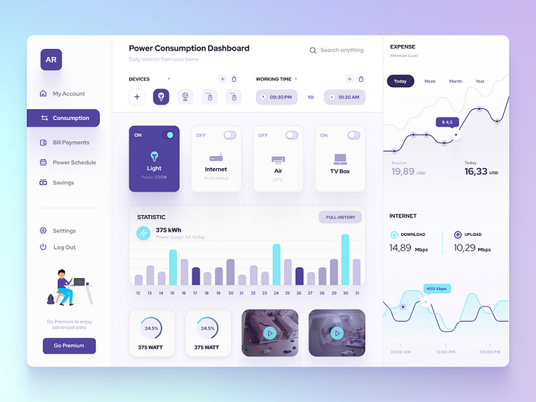
Smart Viewer
A Dashboard for spatial data visualisation, editing, analysis, and database management across Silos. Designed for both technical and non-technical users, it automates workflows to reduce manual and repetitive tasks across teams. Includes automated reporting to support supply and delivery operations.
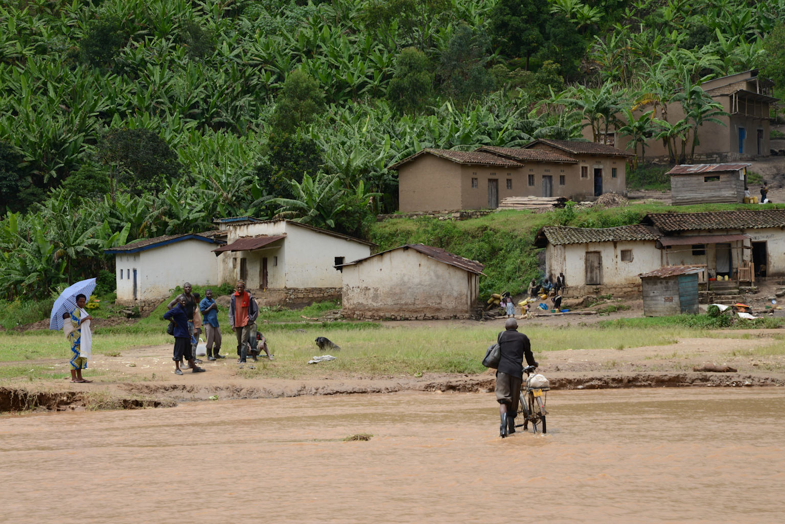
Business Expansion Planning with Spatial Modeling
GIS-enabled planning system for mobile network deployment across Africa and Latin America with CEO acknowledgment in quarterly business paper.
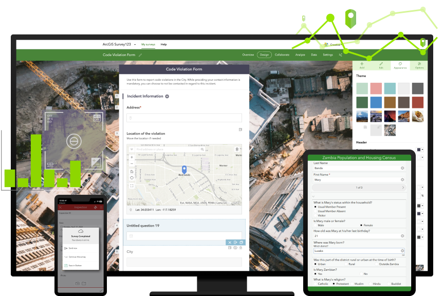
Spatial Digital Workflows with Mobile & Desktop GIS
Modernised traditional manual, paper-based survey approaches using Survey123, FieldMaps and ArcGIS Online system integration.

Training & Mentoring
With over 6,000 hours of teaching and training experience, I’ve trained and mentored a diverse range of users — including environmental surveyors, scientists, technical staff, and GIS professionals — through hands-on coaching, remote instruction, and collaborative knowledge sharing.
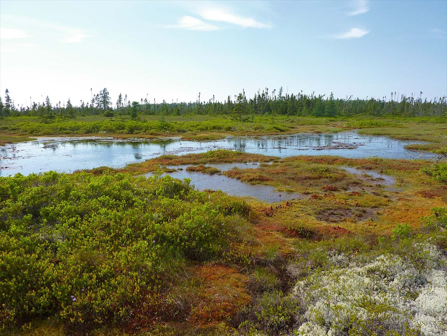
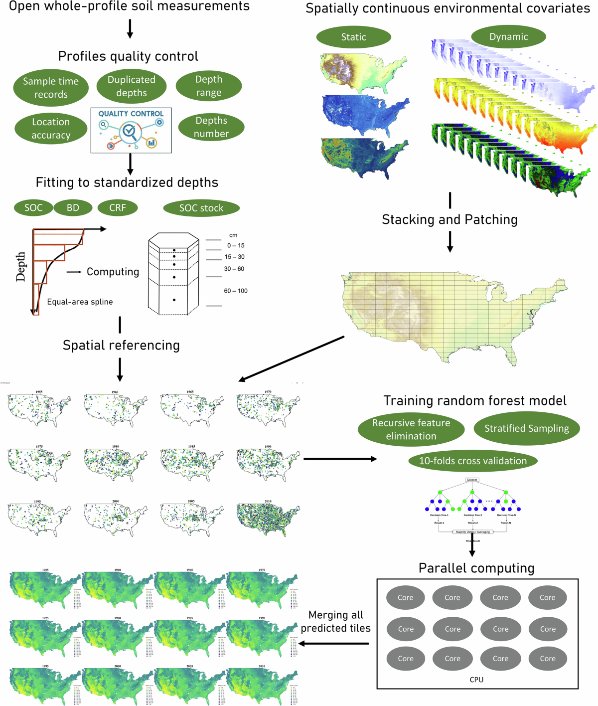
Peat Carbon Flux Analysis
InSAR-based study of peat surface motion and carbon flux in The Great Fen Area using Sentinel-1 data.

AI-Powered Spatial Search Bots
AI-driven bots for enhanced spatial layer searches within organizational GIS systems.
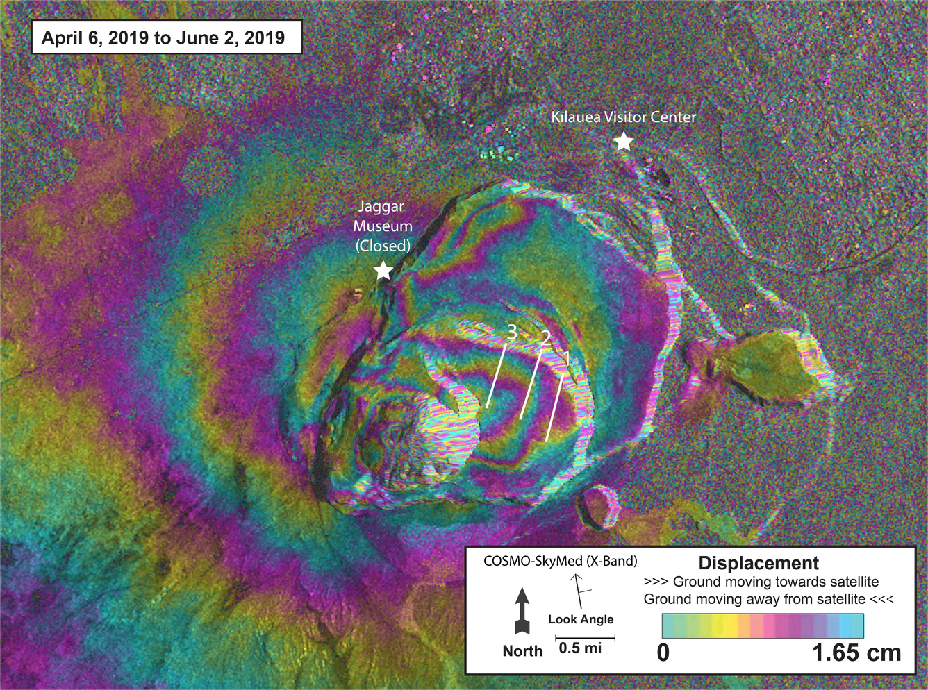
Dam Deformation Detection with InSAR
SBAS-InSAR time-series analysis of the Cadia Gold Mine tailings dam collapse in Australia using Sentinel-1 data from Feb 2017 to April 2018.
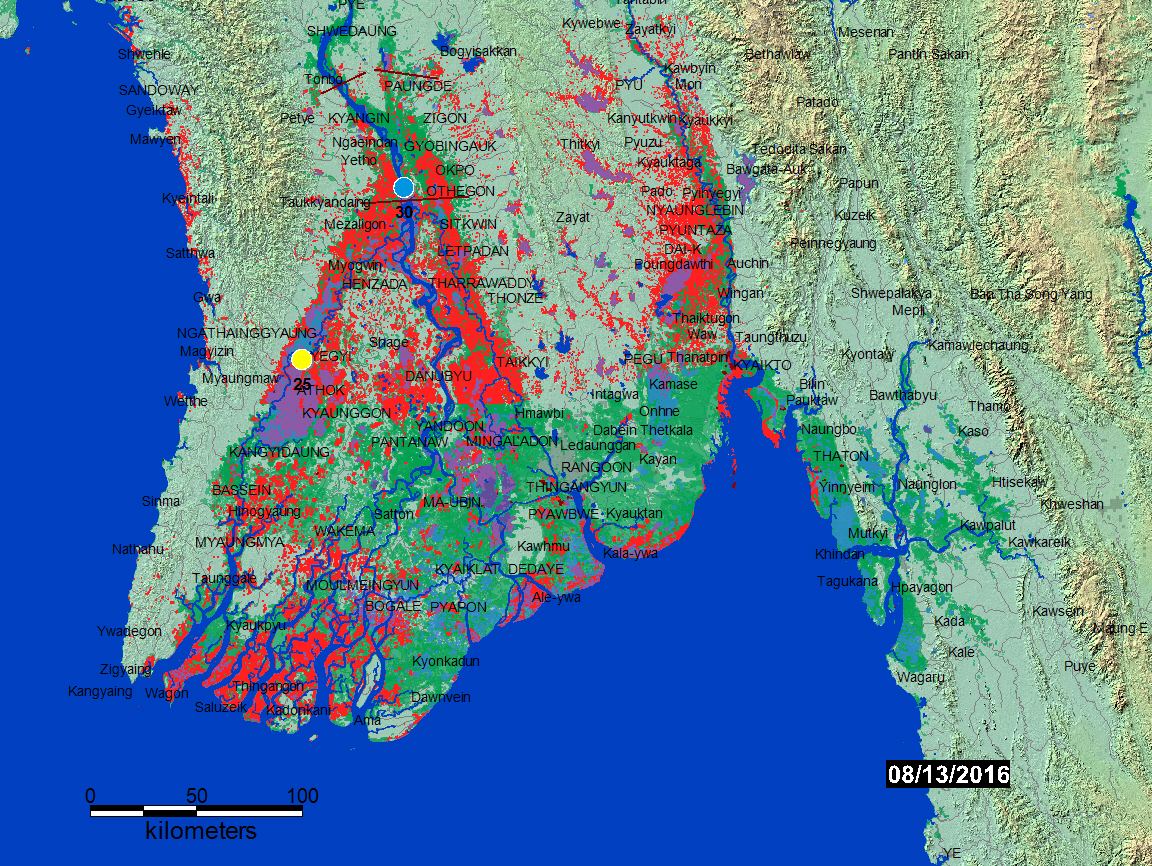
Flood Hazard Mapping Myanmar
Comprehensive flood extent mapping using MODIS Terra and Aqua satellite data with water detection algorithms.
Accuracy Analysis of Aerial Images
Photogrammetry-based accuracy assessment of orthomosaic for Cranfield University Campus with RMSE and NSSDA analysis.
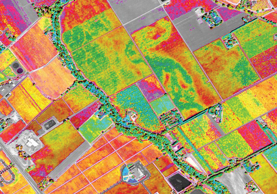
Crop Classification Analysis
Agricultural land use classification for Cambridgeshire focusing on Brassicas and Oil Seed Rape using satellite imagery with 74.70% overall accuracy.
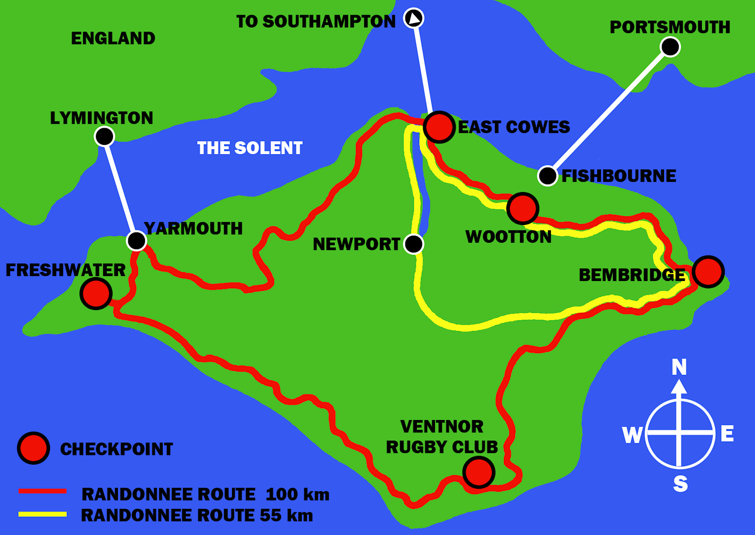
Cycling Route Optimisation
Advanced GIS routing analysis for Isle of Wight with attractiveness index based on landcover and difficulty classification using gradient analysis.
Environmental Resource Survey
Soil Organic Carbon Survey in Dream Island using stratified and random sampling designs with statistical validation.
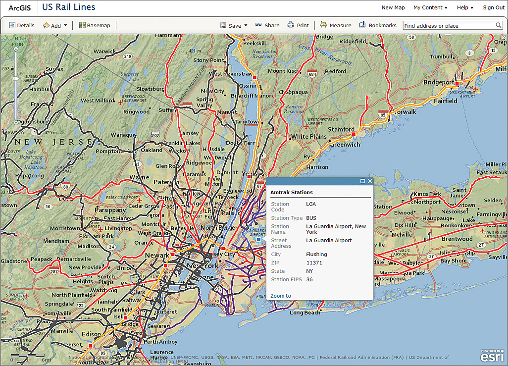
Web Mapping Application
Multi-API web mapping application integrating various mapping services and technologies on university server.
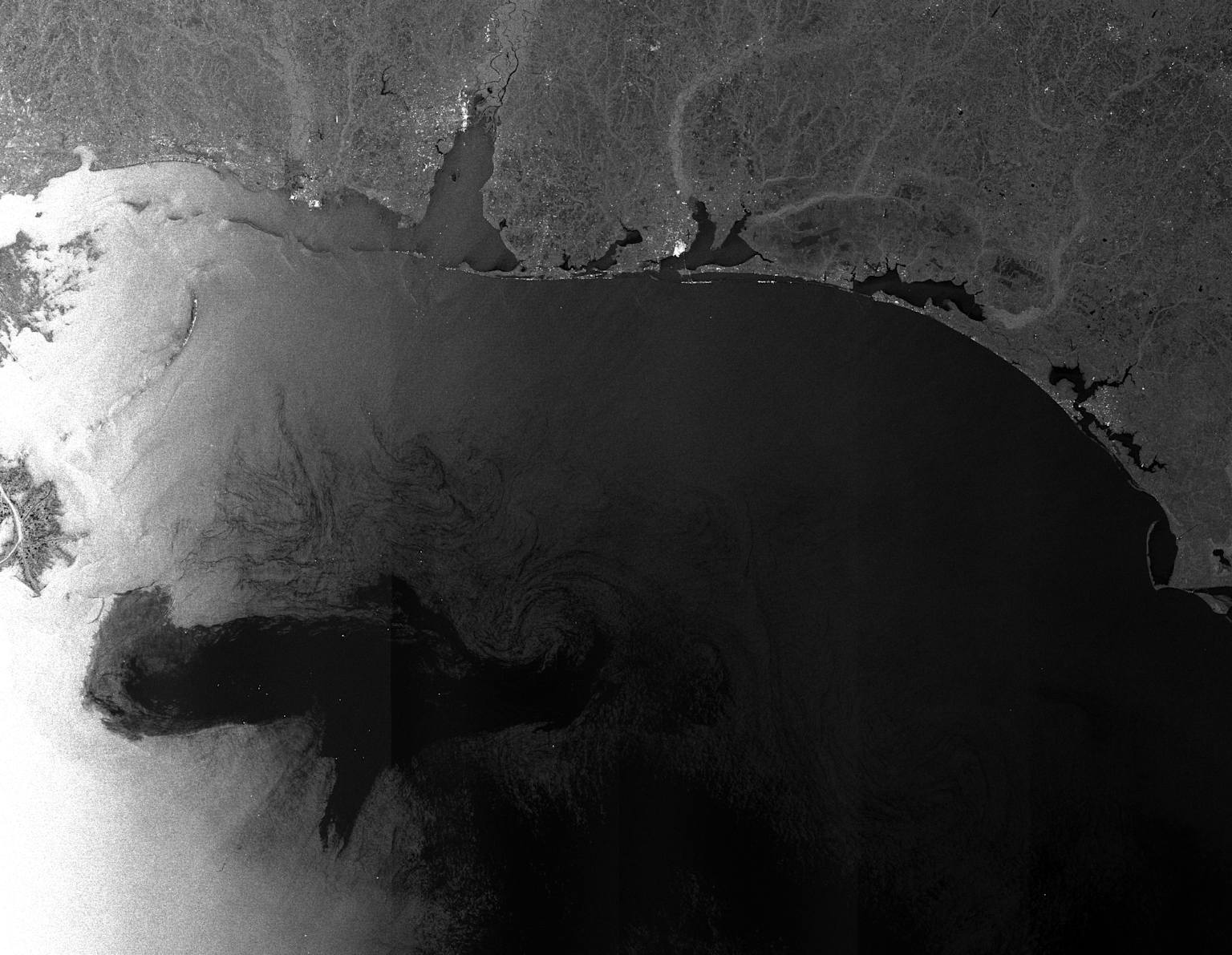
Deepwater Horizon Oil Spill Mapping
Satellite-based analysis of the Deepwater Horizon oil spill impact using radar imagery.
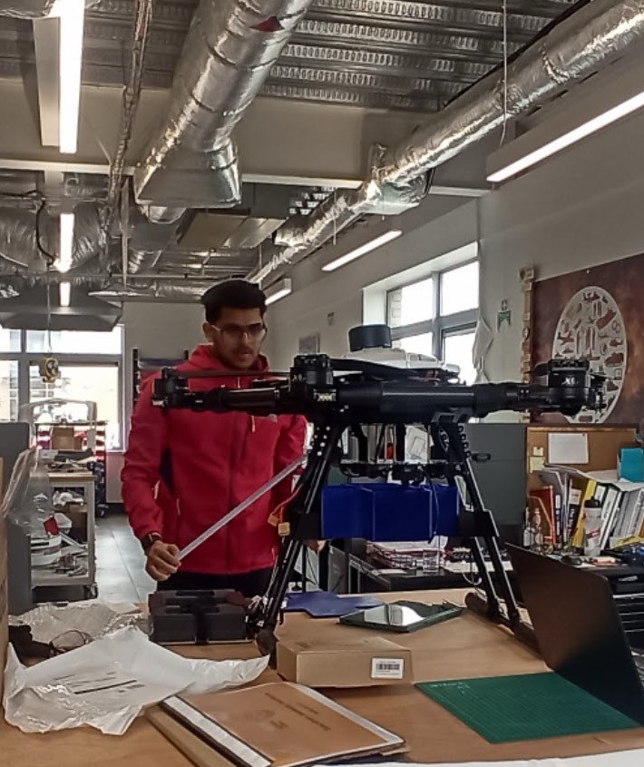
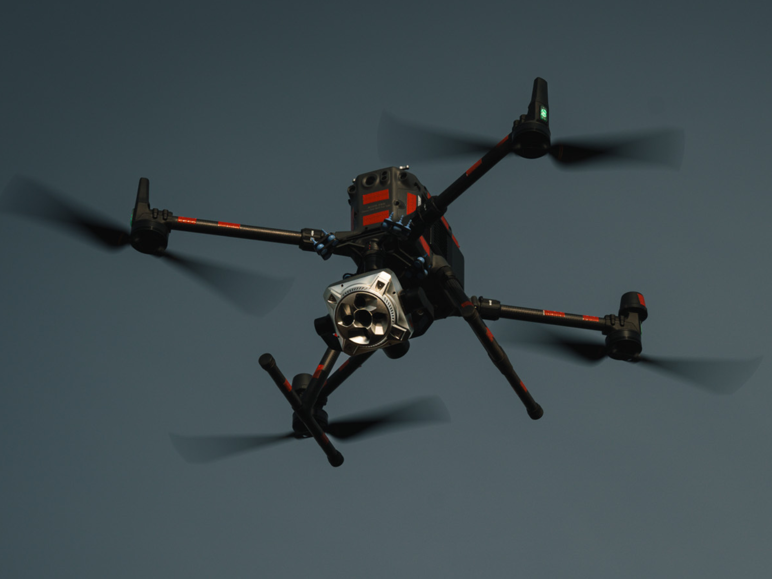
Soil Sampling with UAV
Designed an automated probe capable of collecting multiple soil samples during a single drone flight with several landings.